
Vermont High-Resolution Land Cover
Accurate, high resolution land cover maps are essential to a wide range of landscape analysis and monitoring efforts,
including tree canopy change detection, nonpoint source pollution modeling, carbon stock estimation, spatial epidemiology, and urban planning. The land cover dataset we produced is the state’s most accurate land cover product and is 900 times more detailed than previously-available data. Products include base land cover, supplemental land cover, tree canopy, impervious surfaces, forest patch, and 3D buildings. Vermont is now one of the few states in the nation with wall-to-wall high resolution land cover data and the only state to have such a broad suite of base and supplementary land cover products.
Great Brook Unmanned Aircraft System Mapping
On July 19th, 2015, a series of storms moved through Central Vermont, unleashing nearly 6” of rain.
The flooding resulted in Great Brook, which flows into Plainfield, VT spilling over its banks, damaging and destroying homes and roads. The State of Vermont responded with rescue teams and the towns immediately set out to protect their communities. The University of Vermont immediately activated the Unmanned Aircraft Systems (UAS) team. After coordinating with local officials and the Vermont Agency of Transportation, the UAS team set out to Plainfield to map the extent of the damage. The UAS team had been gathering data for the Great Brook/Plainfield area since December of 2014 as part of a project to map woody debris, which has long been a source of concern due to logs clogging culverts and bridges resulting in flooded roads. The extensive database of imagery collected prior to this recent flood event enabled rapid change detection mapping. Within 24 hours we completed flight operations and conducted a preliminary assessment.
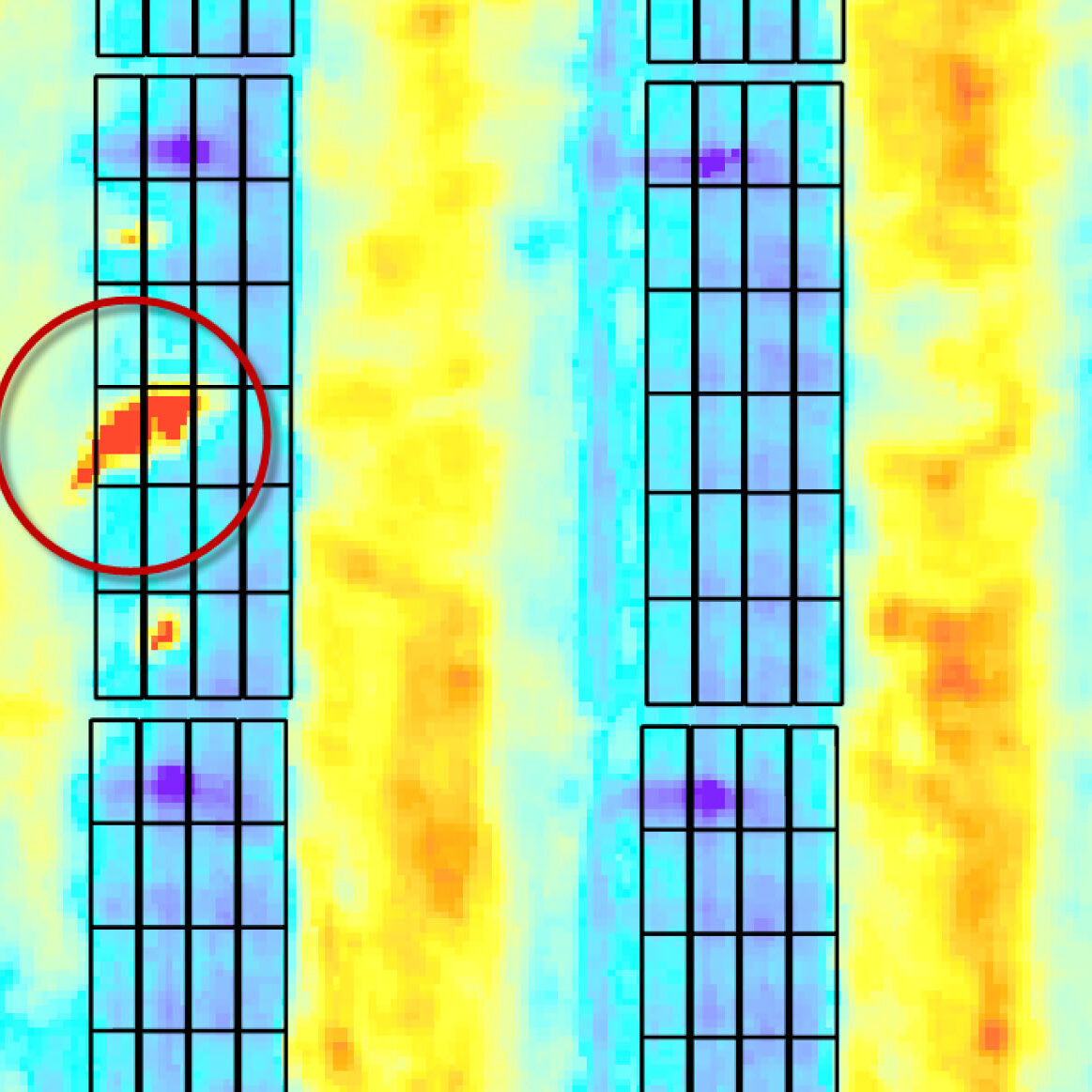
Solar Photovoltaics Unmanned Aircraft Systems Operation and Management Service
Maintaining optimal efficiency of solar panels is critical and costly. Previously, thin film panels had to be manually digitized due to lack of clear borders at panel edges. Drones offer an efficient way to inspect solar panels, yet mapping can still be slow if panels must be manually delineated. We devised a semi-automated, post-processing pipeline to create highly accurate vector delineation of individual solar panels. This solar inspection innovation was developed through a partner project on a 328 megawatt, 1900 acre solar farm with thin film panels. The scalability and efficiency of our feature extraction workflow dramatically reduces maintenance costs by improving solar panel damage assessment.
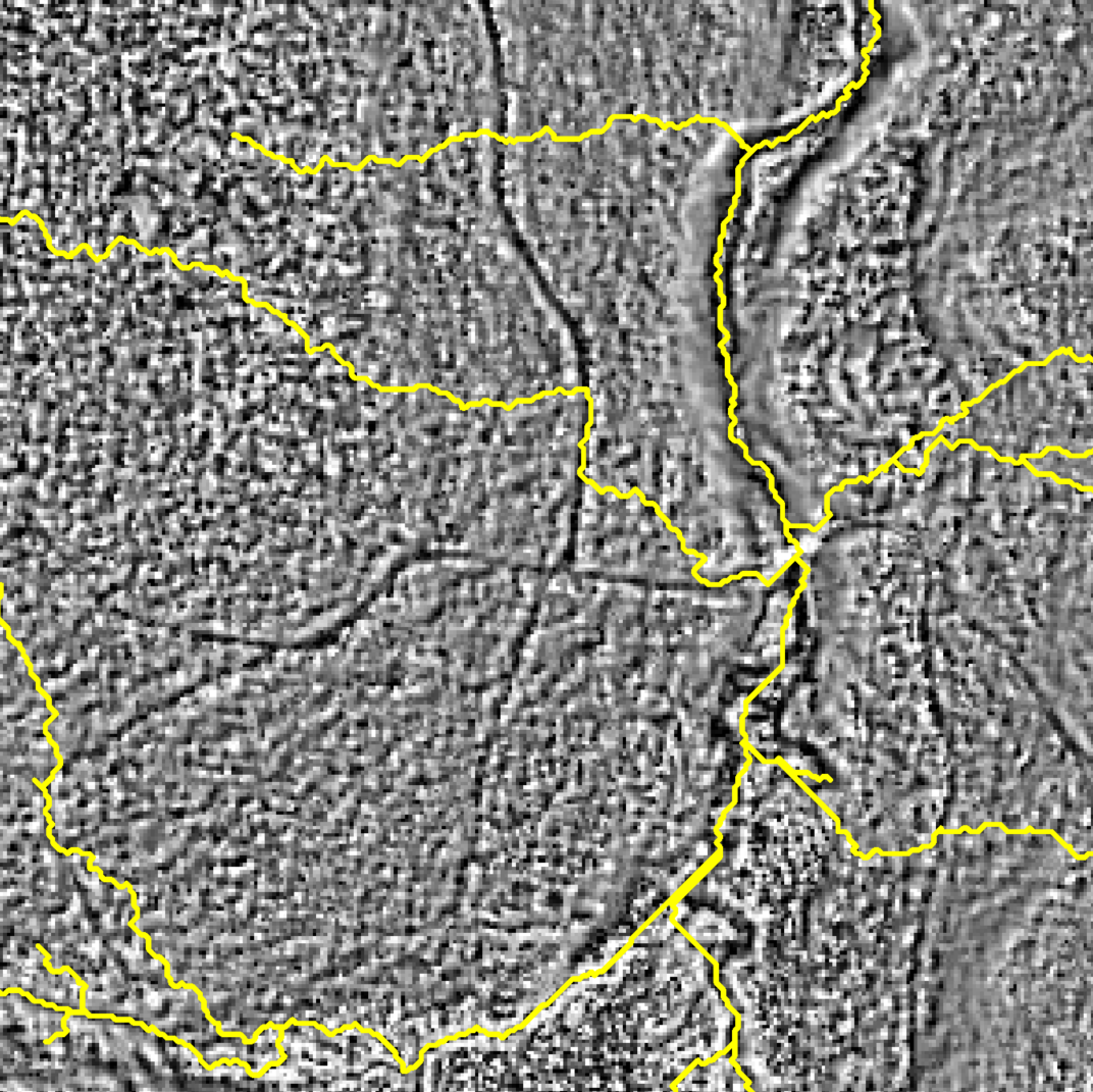
Using LiDAR to Map and Characterize Eroded Forest Roads in the Lake Champlain Valley
Unmapped logging roads and skid paths may be a relatively minor contributor to phosphorus pollution in Lake Champlain, but the extent of their inputs is unknown. We mapped forest roads using a combination of LiDAR-derived surface models and automated feature extraction. Eroded sites were identified by examining gully depth and a stream power index derived from flow potential and slope. Field data verified that the most heavily-eroded sites were captured by automated modeling, even as some topographically indistinct road segments were missed, suggesting that a LiDAR-based approach can be useful for pollution estimation even when comprehensive networks cannot be effectively delineated.
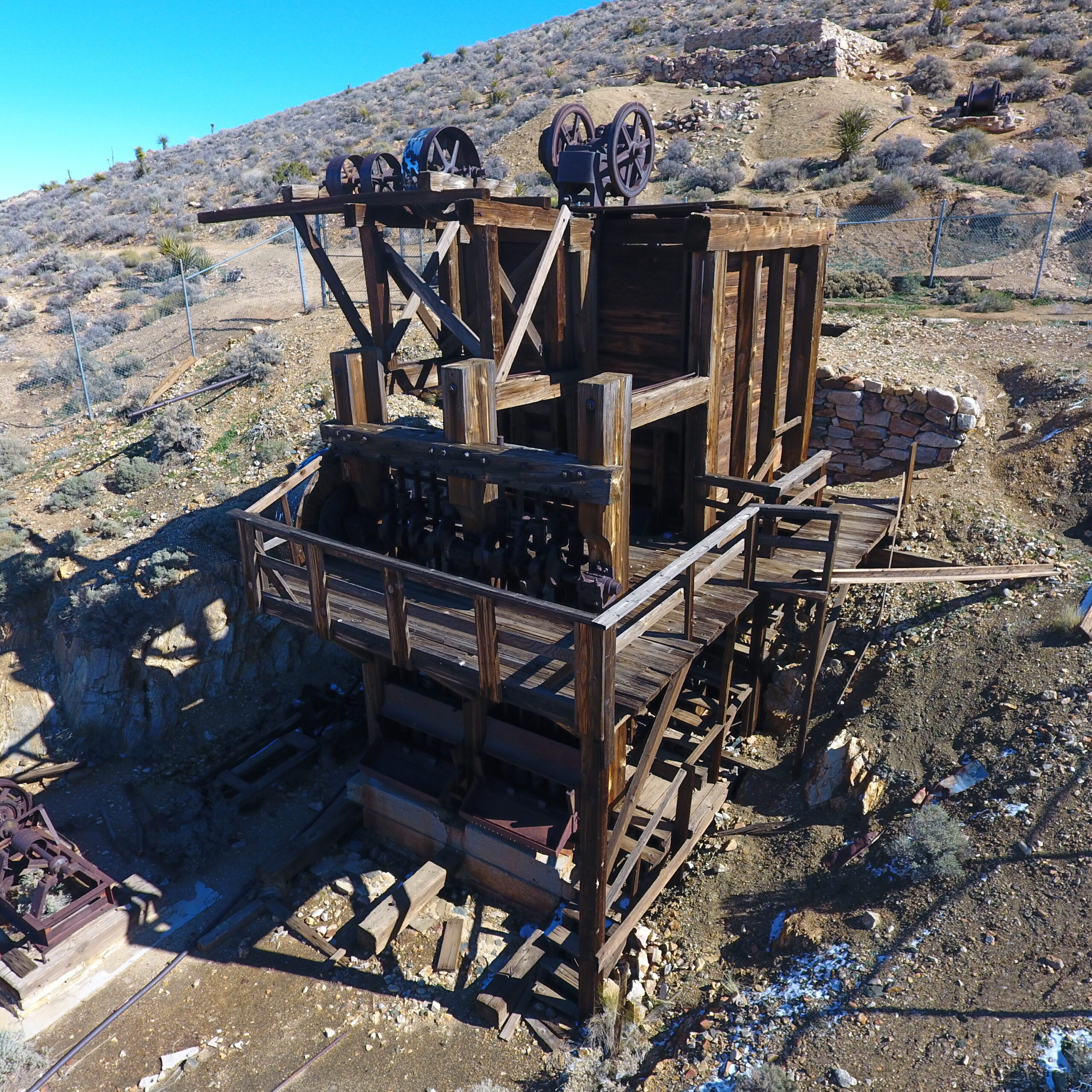
Historical Preservation Documentation
In collaboration with Joshua Tree National Park, the UAS Team collected aerial images of the Lost Horse Mine within the park. The mine was about to undergo a restoration project and due to its cultural importance the park requested to document the mine prior to the project starting. The UAS Team not only collected aerial images of the site, but also produced a 3D point cloud of the mine and surrounding area.
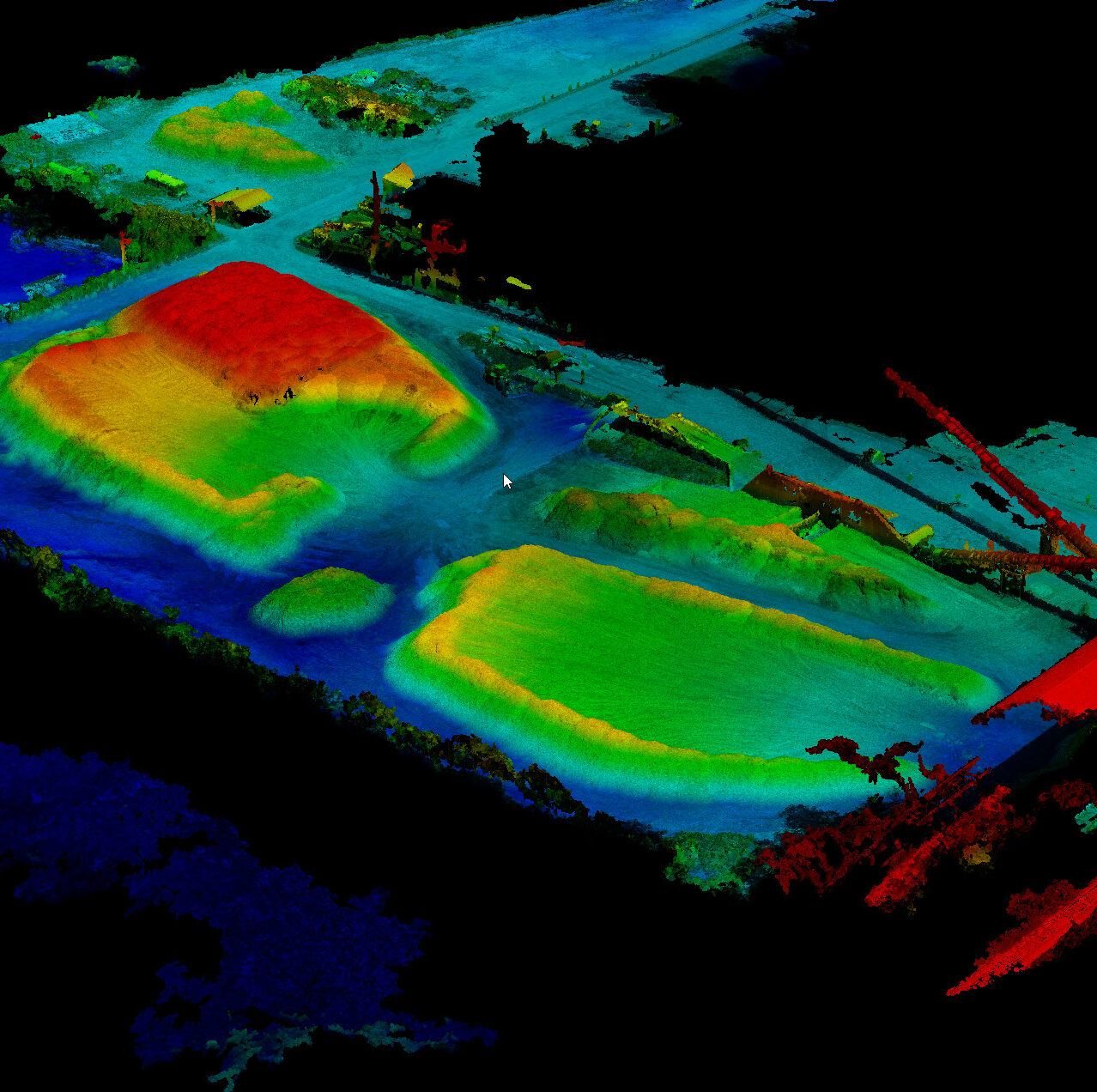
Unmanned Aircraft Systems Volumetric Estimation
Since 2016, the UAS Team has worked with Burlington Electric to generate bi-annual volumetric estimations of the wood chip piles at the McNeil Plant using 3D models generated from overhead UAS imagery. These datasets are produced from a short UAS flight to generate imagery and a digital surface model of the site. The digital surface model is then used to accurately estimate volumes of stockpiles. The illustration above uses warmer colors to show the elevation of the piles.